

Drone Photography for Real Estate: When It Is Worth It (and When It Is Not)
When drone photography genuinely helps sell a listing, when it adds nothing or hurts, and what good real estate aerials actually show. A guide for agents.
By Kyle Romero, FAA Part 107 Remote Pilot
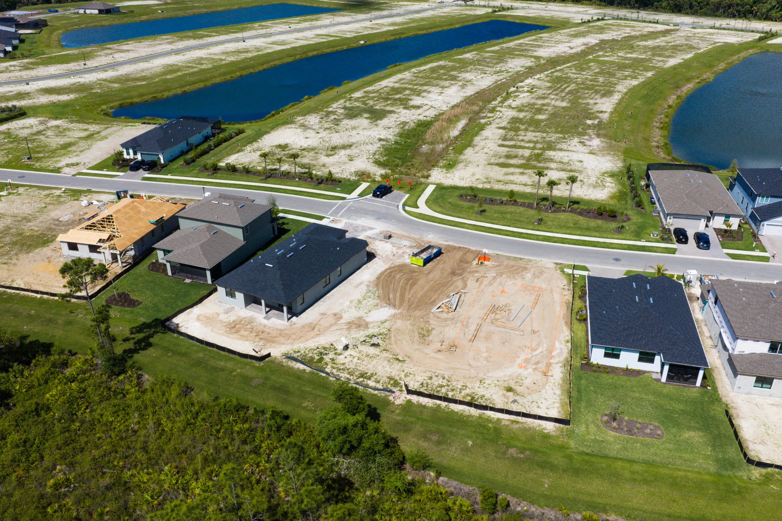
Aerial photos make almost any listing look more important. The trouble is that “more important” and “more accurate” are not the same thing, and buyers spot the gap fast. A drone shot that reveals a property’s relationship to the water, the neighborhood, or its own acreage earns its place in the gallery. A drone shot of a standard interior lot just shows a roof and a few neighbors’ roofs. That does nothing for the seller, and it sometimes raises questions you would rather not invite.
So the honest answer to “is drone photography worth it for this listing?” is: sometimes, and the difference is predictable before you ever book the shoot. Below is how to tell which camp a property falls into, what good aerials should actually capture, and a few things worth knowing about who is legally allowed to fly over your listing in Palm Beach County.
When aerials genuinely add value
Drone photography pays for itself when the most compelling thing about a property is something a buyer cannot see from the ground or the front door. In our market that usually comes down to four situations.
Waterfront and water access
This is the strongest case, and it is everywhere here. On the Intracoastal, the Loxahatchee River, the oceanfront stretches of Jupiter Island, or the canals threading through Tequesta and Palm Beach Gardens, the water is the headline. Ground photos can show a dock or a slice of canal, but only an aerial proves the relationship: how the lot meets the water, whether the dock can handle a real boat, how far the run is to the inlet, and what the view opens up to from the second floor and above.
For a boater, “ocean access, no fixed bridges” is the entire pitch, and an aerial that traces the route from the dock toward the inlet communicates it in a single frame. If you list waterfront and skip the aerials, you are leaving your best argument on the table.
Acreage and large lots
When a property sits on a half-acre or more, ground photography struggles to convey scale. You end up with a string of disconnected images — lawn here, pool there — and the buyer never assembles them into one place. A single overhead or high-angle shot stitches it together: the footprint of the house relative to the land, the privacy of the setback, the pool and patio in context, mature landscaping, and any outbuildings or guest quarters. Equestrian and estate properties west of town live and die on this.
Location and proximity
Sometimes the selling point is not the property itself but what surrounds it. An aerial can show that a home backs up to a preserve rather than another house, sits a short walk from the beach, fronts a golf course, or anchors a desirable pocket of Abacoa. Proximity to amenities is abstract on a map and concrete in a photo. If the location is a genuine asset, an aerial is how you prove it.
Architecture and grounds that read better from above
Courtyard layouts, dramatic rooflines, resort-style pool decks, and dense tropical landscaping often photograph better from a high angle than from eye level. A 45-degree drone shot can reveal a thoughtful site design that ground photos flatten into nothing. This is the weakest of the four reasons on its own, but paired with any of the others it strengthens the whole gallery.
When drone photography is not worth it
Spending on aerials you do not need is one mistake. Publishing aerials that quietly work against the listing is the worse one. Here is when to skip them.
Condos and townhomes. For a unit inside a larger building, an exterior aerial shows the complex, not the home being sold, and it cannot show the one thing buyers care about: the view from that specific unit. Shoot the actual view from the balcony or windows instead. A wide aerial of the building rarely helps, and it can make a unit feel anonymous.
Tight interior lots in dense neighborhoods. On a standard lot packed close to its neighbors, an aerial reveals exactly that — how little separation there is, and how the yard is overlooked. If the lot is the property’s weakest feature, an overhead photo broadcasts it to every buyer scrolling the gallery. Lead with strong ground and interior photography and let the home’s best qualities carry the listing.
When the surroundings work against you. Aerials are honest, which cuts both ways. If the property sits next to a commercial building, a busy road, power lines, a retention pond, or a half-finished construction site, an aerial puts all of it in frame. There is nothing wrong with a buyer learning these things — but you do not need to feature them in the hero image. Disclose in the listing remarks; do not advertise in the gallery.
Bad timing and bad weather. Overcast skies turn the ocean and Intracoastal flat and gray, washing out the exact color that makes an aerial here worth taking. A midday shoot in harsh summer sun produces hard shadows and a bleached-out pool. If the only window is a gray, gusty afternoon, the photo will underdeliver. Reschedule, or skip it, rather than posting a dull frame.
When the budget is better spent elsewhere. On a tight photography budget, strong interiors, accurate twilight exteriors, and a clean, well-staged set almost always do more for a listing than a single aerial. Aerials are a multiplier on a property that has a genuine aerial story — not a substitute for solid fundamentals.
What good real estate aerials actually show
When aerials are warranted, the difference between a useful set and a forgettable one comes down to intent. A good aerial answers a question the buyer is already asking.
- The property in context, with the home as the clear subject. The house should be obvious — centered or thoughtfully composed — not a small object lost in a wide landscape.
- The water relationship, end to end. For waterfront, that means the dock, the lot’s water frontage, and where the water leads, ideally with the inlet, ocean, or open Intracoastal visible in the same frame.
- Honest scale. One shot that captures the full lot and how the structures sit on it, so a buyer understands what “0.6 acres” actually feels like.
- A clean horizon and real color. Level, with sky and water that look the way they do on a good day here, not oversaturated into fantasy.
- A few angles, not a dozen. A tight, edited set is usually one near-overhead for scale, one or two 45-degree hero shots, and possibly one looking out toward the view. Volume is not the goal.
A note on restraint: the temptation with a drone is to keep climbing until the house is a dot. The most useful real estate aerials are often shot fairly low — just high enough to add context — because the buyer still needs to feel connected to the home. Pair them with sharp ground-level and interior work, and they amplify the listing instead of standing apart from it. If you want a deeper look at composition and equipment choices, our Palm Beach County drone photography guide goes further on the craft side.
The Part 107 question, briefly
This part is not optional, and it is worth understanding even though it is your photographer’s responsibility, not yours. Any drone flight for a commercial purpose — and marketing a listing absolutely counts — must be flown by a pilot holding an FAA Part 107 Remote Pilot Certificate. A neighbor with a hobby drone, or an agent flying their own without that certificate, is not legally permitted to produce aerials for a listing.
That matters more here than in most markets because of our airspace. Palm Beach County sits under and around controlled airspace tied to Palm Beach International and several smaller fields, and parts of Jupiter and the coast carry their own restrictions. A certified pilot knows when a flight needs prior airspace authorization, where altitude is capped, and where flying is simply off-limits. Hiring a licensed studio is not just a compliance checkbox — it is the difference between a shoot that happens on schedule and one that gets grounded or, worse, draws a complaint. If you want the specifics on what is and is not allowed, we wrote a plain-English breakdown in our guide to drone photography laws in Florida.
The short version for agents: ask any photographer for their Part 107 certificate before the listing goes live, and ask whether the address needs airspace authorization. A studio that handles real estate work in this county should answer both without hesitation.
A quick decision checklist
Before you book aerials, run the listing through this:
- Is the headline feature visible only from above? Water access, acreage, a standout location, a dramatic site design. If yes, book them.
- Will an aerial reveal something you would rather not feature? Crowded lot, awkward neighbors, an unflattering surrounding. If yes, lean on ground and interior work instead.
- Is the weather and timing right? Clear skies and good light, ideally morning or late afternoon. If not, reschedule.
- Are the fundamentals already covered? Strong interiors and exteriors first. Aerials are a multiplier, not a rescue.
Two or more yeses in the first three, with the fundamentals handled, and aerials will likely earn their cost. If not, the money is better spent elsewhere in the shoot — which is exactly how we think about it on every real estate photography project we take on.
The bottom line
Drone photography is worth it when a property has a real aerial story to tell — waterfront, acreage, a location that sells itself. It is a waste, or a liability, when it does not. The skill is not in flying higher; it is in knowing which listings deserve to be seen from the sky and shooting them with restraint and accuracy. Used that way, aerials become one of the most persuasive tools in the gallery rather than filler.
If you have a listing coming up and you are not sure whether aerials will help, send us the address and we will tell you honestly. Get in touch and we will take a look.